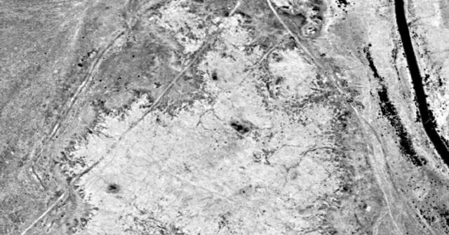
Archaeologists pinpointed the location of the Battle of al-Qadisiyyaha which took place in what is now Iraq in 636 AD by combining space technology and historical texts.
The clash was a key victory for Arab Muslims in their expansion beyond Arabia, and remains part of the core curriculum for students of Arabic history.
But, until now, its precise location was not clear.
A team from Durham University led by Dr William Deadman, a specialist in archaeological remote sensing, conducted the research with colleagues at the University of Al-Qadisiyah in Iraq.
The researchers were undertaking a remote sensing survey to map out the route of the Darb Zubaydah, a Hajj pilgrimage route from Kufa in Iraq to Mecca in Saudi Arabia built over 1,000 years ago.
The survey used declassified US spy satellite imagery from the 1970s and compared these to modern day images and historical texts, to understand the stopping points along the route.
During their work the team realised they were also able to use sites and structures detailed in the historical texts, such as walls and settlements, which were also visible on the 20th
Century satellite imagery, to accurately identify the location of the battle.
Their analysis, published in the journal Antiquity, places the battlefield around 18 miles (30 kms) south of Kufa in the Najaf Governorate.
The research also allowed the team to confidently identify the locations of two stopping points along the Darb Zubaydah – al-Qadisiyyah and al-‘Udhayb.
On-the-ground surveys by colleagues from the University of Al-Qadisiyah support the findings.
Dr Deadman said: “This discovery provides a geographical location and context for a battle that is one of the founding stories of the expansion of Islam into modern day Iraq, Iran and beyond.
“During our survey work we were able to identify a six-mile-long double wall feature linking a military complex on the desert fringe and a large settlement on the edge of the southern Mesopotamian floodplain.
“This corresponded remarkably well to details within the rich body of historical sources relevant to the battle of al-Qadisiyyah and the stopping points along the Darb Zubaydah.
“To be able to use our survey work to not only identify a key historical battle site, but also the locations of two key settlements along the Darb Zubaydah, is hugely exciting.”
The Durham team worked on remote satellite sensing – using satellite images from past and present day – to assess and understand the region more fully.
Researchers in Iraq undertook detailed analysis of historical texts to help inform the remote sensing work, and conducted rapid assessments on the ground.
Dr Rajwan Almayali , of the University of Al-Qadisiyah, said: “I am thrilled that researchers from Al-Qadisiyah University and Durham University were able, through working together, to discover the exact location of the historic Battle of Al-Qadisiyyah.
“We hope that researchers and students of the two universities will continue to learn the secrets and mysteries of the archaeology and history of Mesopotamia.”
The researchers hope that a full field survey can be conducted to investigate their findings in depth on the ground.
The discovery was made as part of the wider Endangered Archaeology in the Middle East and North Africa (EAMENA) project.


